539
FXUS66 KSGX 162037
AFDSGX

Area Forecast Discussion
National Weather Service San Diego CA
137 PM PDT Thu Apr 16 2026

.SYNOPSIS...
A little cooler today than yesterday under cloudy skies, with
southwest to west winds gusting 35 to 45 mph in the mountains and
deserts during the afternoon and evening. The flow will turn
offshore on Friday, with warming for the coast and valleys and
continued cooling for the deserts. There will be north to
northeast winds along and below the coastal slopes of the
mountains, peaking Friday morning with gusts to 35 to 45 mph. For
the weekend, weaker winds and warmer inland with Sunday high
temperatures 5 to 10 degrees above average. Some time during the
early to middle part of next week, a low pressure system will move
into California bringing cooler and breezy weather with a less
than 20 percent chance of measurable precipitation.

&&

.DISCUSSION...FOR EXTREME SOUTHWESTERN CALIFORNIA INCLUDING ORANGE...
SAN DIEGO...WESTERN RIVERSIDE AND SOUTHWESTERN SAN BERNARDINO
COUNTIES...

This afternoon...a low pressure system to our southwest continues
to bring widespread mid and high clouds to SoCal, along with
onshore flow and slightly lower temperatures. The marine layer has
been disrupted by this system and there is no significant inversion
and very few low clouds, mostly over the coastal waters. As this
system moves inland over northern Baja this evening and tonight,
the onshore flow will strengthen briefly producing westerly winds
locally gusting 35 to 45 mph in the mountains and deserts.

For late tonight into Friday morning...a surface high will move
into the Great Basin, briefly setting up offshore flow. Gusty
north to northeast winds will develop early Friday morning, peak
during the day and weaken Friday evening. Gusts of 35 to 45 mph
are expected in and below the Cajon Pass, along and below the
coastal slopes of the Santa Ana Mountains, and in northern and
eastern portions of the Coachella Valley. The offshore flow will
also bring about 5 degrees of warming to the areas west of the
mountains but the deserts could be about 5 degrees cooler than
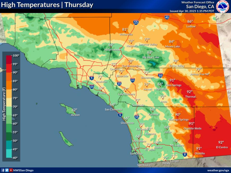
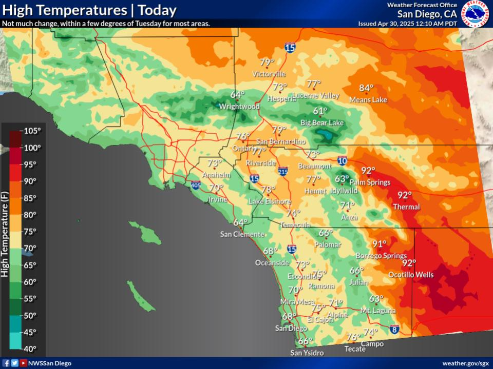
today. High temperatures on Friday will be mostly in the 70s for
the coast and valleys to around 80 for the western valleys and
inland coastal areas with high temperatures for the lower deserts
in the lower to mid 80s.

The offshore winds will weaken on Saturday and a transient ridge
of high pressure ahead of a low pressure system, developing south
of the Gulf of Alaska, will bring daytime temperatures about 5-10
degrees higher than Friday. High temperatures are expected to
range from the lower 70s near the coast to the lower to mid 80s
for the Inland Empire with the lower deserts around 90.

Warming will continue for inland areas on Sunday under southwest
flow aloft ahead of the low pressure system moving southward off
the CA coast. High temperatures on Sunday will likely be 5 to 10
degrees above average for most areas. Sunday high temperatures
will range from the lower 70s near the coast to the lower to mid
80s for the Inland Empire with the lower to mid 90s for the lower
deserts.

For Monday through the middle of next week...Model solutions have
not yet begun to converge on a solution so forecast details are
quite uncertain. The low pressure system will move inland over CA
by Wed or Thu. We can say with reasonable confidence that conditions
will be cooler and breezier with increasing clouds. Almost half
the ensemble members across model platforms indicate the potential
for measurable precipitation but timing and amounts are uncertain.
At this time, the National Blend of Models indicate a 15%-25%
chance of measurable precip between next Tue and Thu.

&&

.AVIATION...
161800Z...Coast...Low clouds along the coast this morning have since
scattered out, with VFR conditions expected through the afternoon.
There is a window of low clouds (near 2000ft MSL)to temporarily move
back into the coastal TAF sites between 04-08z Friday before
offshore flow sets in and pushes any clouds back off the coast.

Valleys/Mountains/Deserts...Strong southwest to west winds are
expected through 06z this evening with gusts up to 30 to 40 knots,
particularly in the mountains and deserts. MOD up/downdrafts in lee
of mountains, along with local BLDU in deserts. Winds to shift to
offshore (northeast) after 06z tonight in the coastal foothills and
into the northern Inland Empire, increasing Friday morning.

Otherwise...BKN high clouds AOA 20000 feet MSL decreasing after 00Z.
VFR conditions expected today through tonight.

&&

.MARINE...
No hazardous marine conditions are expected through Monday.

&&

.SKYWARN...
Skywarn activation is not requested. However weather spotters are
encouraged to report significant weather conditions.

&&

.SGX WATCHES/WARNINGS/ADVISORIES...
CA...Wind Advisory from 5 AM to 5 PM PDT Friday for Orange County
     Inland Areas-San Bernardino County Mountains-San Bernardino
     and Riverside County Valleys-The Inland Empire-Santa Ana
     Mountains and Foothills.

     Wind Advisory until 2 AM PDT Friday for Apple and Lucerne
     Valleys.

PZ...None.

&&

$$

PUBLIC...PG
AVIATION/MARINE...Zuber/Munyan
NWS San Diego (SGX) Office


